New Zealand, South Island-2 Week Road Trip in a campervan
Friday 1st October-Thursday 14th October 2010
Day 1-4 (out of 14 days travelling around South island, NZ)
Map of our Route on the South Island
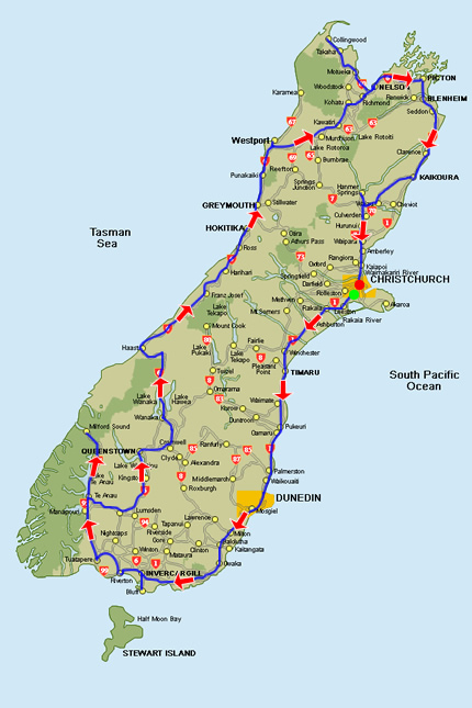
Route we took on the South Island
We spent 3 weeks touring around North island New Zealand and after having such a great time in our camper there, we decided we would go with the same company on the South Island (Spaceships), for 2 weeks. Having a camper really gives you the freedom to be flexible and wake up and decide where you want to go. We wouldn’t of seen half of the places without having our own vehicle. Plus it has been our accommodation for the last 5 weeks, so we saved a lot of money staying in the camper.
We had heard that the South Island was even more beautiful than the North Island. We had seen so many beautiful places already on the North Island and didn’t see how this could be possible. Well after spending 2 weeks touring around the South Island I can stand by what the majority of people have told us about the South Island, it is by far the most beautiful part of the world we have seen so far. Each country has had something different that stood out to us, but New Zealand wins the top award for pure and natural beauty!
There is so much contrast in scenery in New Zealand, high mountains, low plains, fiords, forests, glaciers, rivers, lakes, waterfalls, beaches ect. We were constantly wanting to stop to take pictures. There wasn’t 5 minutes that went by without seeing something that we wanted to stop and look at.
I will write about the highlights from each day, but there is just so much to write about that you will have to wait to see us, to hear about everything in more detail. We slept in our camper every night this time, and showered in various public shower facilities we found along the way. When we asked at the I-Site they would tell us where there were shower facilities.
Day 1- Friday 1st October 2010 Christchurch-Timaru
Today we picked up our camper van at about 9am. After going to the supermarket to get some food for the road we headed south from Christchurch to Timaru. As soon as we got on the road we were able to see snowy mountains all around us.
We stopped briefly in Ashburton then continued onto Timaru (160km from Christchurch).
Timaru has been constructed on rolling hills created from the lava flows of the extinct Mt Horrible volcano, which last erupted many thousands of years ago. The result is that most of the main streets are undulating, a clear contrast with the flat landscape of the Canterbury Plains to the north. This volcanic rock is used for the construction of local “bluestone” buildings. (WIKI)
Timaru was a really scenic town, surrounded by snowy mountains. We decided we would stay here for the night, so we parked our camper up. We took a walk over to Caroline Bay Beach. There is a really nice park there with out door exercise equipment for the public to use and a massive park area for joggers.

Timaru-Caroline Bay
Day 2- Saturday 2nd October 2010
This morning we went to Caroline Bay to enjoy the scenery of the mountains and we also decided to play Frisbee for a while. I was trying to master my Frisbee skills, Paul was giving me lessons on how to throw in the right direction. I will have to keep practising. Paul also wanted to test out his model aeroplane that I’d bought him for his birthday.
Then we set off to Oamaru (80km from Timaru). This town has a lot of Victorian and Edwardian heritage, which is easy to see when you visit, as they have kept a lot of the original buildings and all the new buildings keep in style with the rest. I really liked this town, it had so much character. There was a radio station called ‘Heritage Radio Station 88.3′. I went in to speak with the guy running the radio station. He showed me around. There wad loads of old radio and recording equipment that had been donated to the radio station. The radio station is run by volunteers.

Various old radios-Oamaru Heritage Radio Station

Paul on his big bike-Oamaru
We spent about 1-2 hours looking around Oamaru, then we set off to Dunedin (120km South of Oamaru). We arrived in Dunedin at about 5pm. Dunedin is the second largest city in the South island. The word Dunedin is an old Gaelic word meaning Edinburgh. Like Oamaru, Dunedin has also preserved their Victorian and Edwardian heritage. This is also very clear in the style of their buildings around the whole city. Dunedin was one of our favourite city’s. Tonight we just took a quick walk around the city and then got an early night, ready to explore Dunedin in the morning.
Day 3- Sunday 3rd October 2010
This morning we went to see New Zealand’s only Castle, Larnach Castle-although it wasn’t really a castle as such, just the closest thing they have to castle. It is in a beautiful location, just outside of Dunedin and overlooking the Otago Peninsula. It was built in 1873 as the residence of William Larnach, who was a politician. The house was left to despair after William Larnach committed suicide, and it was later bought over by the Barker family in 1967. It is now open to the public. We just paid for entrance to see the castle from the outside and the gardens. This cost $12 each (£6).
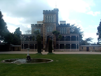
Larnach Castle

View from Larnach Castle
After looking around the gardens and enjoying the views, we drove on to Taiaroa Head, on the Otago Penisula. This is where the Royal Albatross center is and where you can view the Royal Albatross…unfortunatley we didn’t get to see one, but we went to centre anyway to learn about them. They fly from 500-1000 km a day and spend 80% of their time in the air. Their wing span is up to 3m. We did see the ‘Little Shag’ bird however.
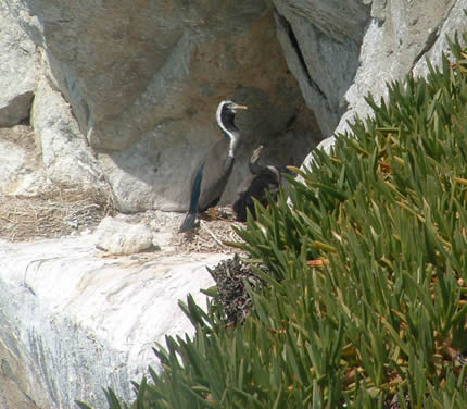
Little Shag
The view from Taiaroa is beautiful, just like everywhere in New Zealand.

View from Taiaroa Head
Next we drove on to Sanymount Road, where there are several short walks to beautiful view points. We walked up to a lookout of the Otago Peninsula.
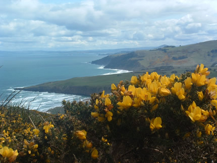
Lookout of Otago Peninsula
We then walked over to lovers leap, where there was an archway in a rock.

Lovers Leap
We drove back to the city at about 4pm and spent the remainder of the day looking around Dunedin. The buildings are all victorain and Edwardian style.
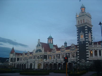
Dunedin Railway Station
Day 4-Monday 4th October 2010
Today we set off towards Invercargill, on the tourist route, taking about 5 hours, with stops along the way.
Here is a list of our stops along the way to Invercargill
Nugget Point-Lighthouse
We drove to nugget point where you can see yellow-eye’s penguins at certain times of day. We looked and looked, but couldn’t see any. We then drove on to the lighthouse at nugget point.

Nugget Point-Lighthouse
Purakanui Falls
This is a cascading waterfall.

Purakanui Falls
Matai and Horse shoe falls
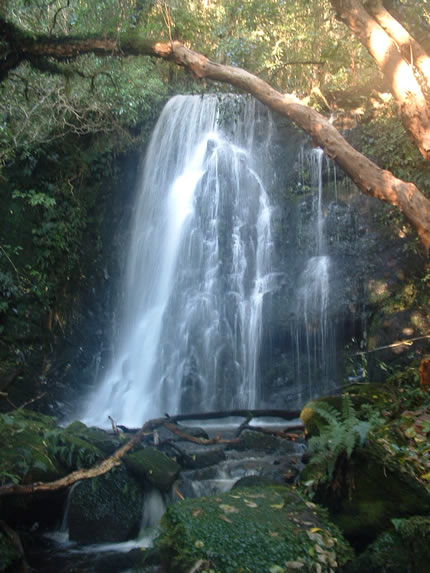
Matai Falls
Florence Point Lookout-where you can see the Bluff in the distance-South Islands most Southern town.

Florence Point Lookout
Lastly we watched a beautiful sunset over the plains about 30 minutes drive from Invercagill. We were on a road where there were no houses, just the sound of birds and all we could see was greenery and tree’s….such a beautiful site!
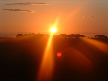
Sunset over the plains
We arrived in Invercargill at about 9pm.
I will write about the rest of our time on the South Island as soon as possible.
Ruth and Paul


January 13th, 2022 at 1:28 am
3helicopter…
…